
THE CHOICE OF PROFESSIONALS
Custom GNSS/IMU/LiDAR hardware and software accuracy solutions.
Positioning systems for terrestrial, manned aerial and UAV mapping.
The Klau Geomatics KlauPPK product suite includes hardware kits for accurate aerial mapping, compatible with most cameras, whether on drones or manned aircraft.
Now integrating a range of IMUs from leading manufacturers to support LiDAR and other applications.


-
Custom end-to-end systems
-
IoT and sensor integration
-
Hybrid PPP/PPK on desktop and cloud
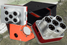
The new Brumby LiDAR
Mobile Mapping from vehicles, boats, handheld, helicopters and planes.
Brumby LiDAR
End to end LiDAR solution, hardware, software and data delivery.
-
NovAtel GNSS, Honeywell IMU and Ouster LiDAR
-
PPP optimized for tightly coupled GNSS/IMU ‘MakeItAccurate’ high accuracy positioning – without a base station
-
Chabok Pro point cloud georeferencing software.
3cm accuracy – without pointcloud registration

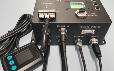
The 7700C
Built for integrators.
KlauPPK 7700C
For LiDAR integrators and IoT developers
-
Connects to various IMU/INS products, Vectornav, Honeywell, Pixhawk, and others
-
Data handshake, timing synchronization, and consolidated data logging.
-
PPP optimised for high accuracy positioning without a base station
-
MakeItAccurate bundle for PPP post processing and tightly coupled IMU processing
OEM conversations welcome.

FEATURES
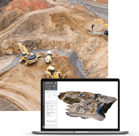
KlauPPK is the professional choice for accurate aerial surveying and inspection.

HIGHEST ACCURACY PPK & PPP
2 to 3cm accuracy in XY&Z on the ground.
Reliable, repeatable.

NO GROUND CONTROL POINTS (GCPs)
Save time in the field with our hardware software and methodology to minimize or eliminate GCPs.

VERSATILE DESIGN TO PLUG & PLAY ON ANY PLATFORM
Compatible with many sensors on drones and manned aircraft. Modular design.

ADVANCED PPK & PPP PROCESSING & GEO-TAGGING
Survey grade desktop or cloud processing for GNSS processing, photo geotagging, coordinate transfromations and localization.

GLOBAL REAL TIME 3CM POSITIONING SOLUTION
No base station solution to achieve high accuracy in real time anywhere in the world. Connect directly to your sensors and flight management.

PPK PPP PROCESSING AS A SERVICE
No base-station, just upload your raw GNSS data and receive corrected positions with 5-10cm accuracy anywhere in the world.
WHY KLAU PPK?
Proven professional solution
KlauPPK systems are developed by geospatial professionals for geospatial professionals. Aerial surveying traditionally required many GCPs (ground control points) across the site to achieve reasonable absolute geo-positioning accuracy. With the KlauPPK system there is a simple, effective solution to save hours or days in the field and achieve even better results.
The Klau PPK direct georeferencing system, a synergy of hardware, software and methodology, is the most accurate precision surveying technology for mapping with drones and manned aircraft.
With Klau PPK direct georeferencing, you can cover larger areas in a single flight by reducing the side overlap down to 40%. You no longer need to place GCPs across your entire site (do have some check points though to prove just how accurate it is). Photogrammetry processing is faster and more accurate.
HARDWARE
Based on highest quality GNSS technology
Klau Geomatics uses industry-leading NovAtel GNSS hardware at the core of its products.
Proven and tested with millions of hours in space, aerial, marine and terrestrial environments, this technology offers the highest levels of interference mitigation and signal processing.
With full constellation data logging, precise camera synchronization, distance-based camera triggering options and global corrections options, KlauPPK is the most sophisticated system of its kind.

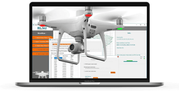
SOFTWARE
Professional Survey Software
KlauPPK software is available on desktop or cloud, with advanced processing options and sophisticated survey calculations.
Options for worldwide no-base-station processing or BYO base station solutions. KlauPPK software manages lever arm corrections, IMU data, datum and coordinate transformations, application of geoid models and site localization.
COMPATIBILITY
Klau PPK is compatible with most UAVs and manned aircraft, and has been used in marine, vehicle and handheld environments. Improve your existing hardware and workflows with KlauPPK technology
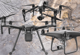
Compatible with most popular commercial drones
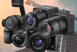
Compatible with many drone, DSLR and aerial cameras
Ruggedized systems for manned aerial mapping
Compatible with many sensors such as Near Infra Red and Thermal
NEWS
Keep up with the latest news from Klau Geomatics

Company Bio in NovAtel Velocity Magazine
Klau Geomatics recently featured in NovAtel Velocity magazine. Get some background on our company, our tech and our vision.
https://novatel.com/tech-talk/velocity-magazine/velocity-2021/advanced-gnss-positioning-for-uav-applicationsAdvanced GNSS positioning for UAV applications
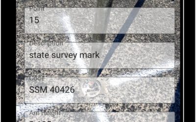
New Ground Surveying App from Klau Geomatics
The KlauPPK phone app enables you to collect points with a name, description and code, just like a typical survey controller.
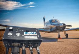
Making Manned Aerial Mapping Accessible
Between the worlds of high cost commercial manned aerial mapping and professional UAV mapping, lies an alternative of affordable and accessible large scale aerial mapping option.