by Klau Geomatics | Nov 24, 2020 | Press release
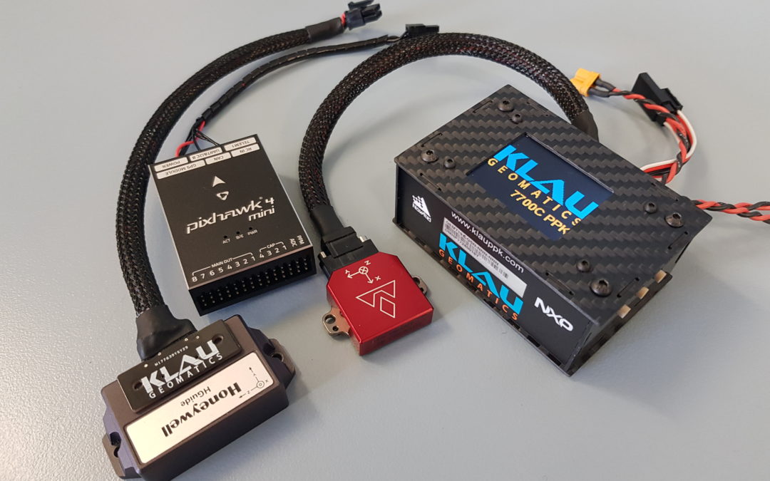
Klau Geomatics is releasing the 7700C integration platform, a GNSS hardware system designed to integrate with external IMUs and IoT devices. The KlauPPK hardware/software product has been an industry leader in aerial mapping for over 5 years, with ongoing improvements...

by Klau Geomatics | Oct 16, 2020 | Press release
With the release of the new CONDOR V8-PPK mapping drone, Munich (Germany) based Videographics Ingenieurgesellschaft mbH has built the tool for precise photogrammetric aerial mapping and surveying projects. Introducing the CONDOR V8-PPK mapping drone, developed by...
by Klau Geomatics | Oct 1, 2020 | Press release
Japan’s Ministry of Land, Infrastructure, Transport and Tourism have re-written their UAV capture specifications based on results using KlauPPK technology. The Guideline for work-type management using aerial photogrammetry (earthwork) specifies the procedures to be...
by Klau Geomatics | Jul 10, 2020 | Press release
The M300 has hit the ground running with rave reviews on its capabilities. It features long flight time, good payload capacity, many refinements that I am sure you have read about if not seen in person. The inspection camera is a game-changer, with RGB, thermal and...

by Klau Geomatics | Jun 20, 2020 | Press release
Over the past decade, the process of creating accurate 3D maps and models from drone photos has come a long way. Drone capture capabilities and photogrammetry processing software and services have improved in cost and efficiency to a point where 3D digital twins are a...
by Klau Geomatics | Mar 10, 2020 | Press release
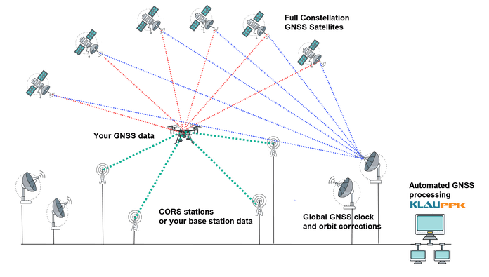
Post Processed Kinematic (PPK) has been the positioning tech of choice for the past few years. Drone operators have seen the advantages of PPK over RTK in the quest increased efficiency and accuracy with less dependence on Ground Control Points (GCPs). Now Precise...

Recent Comments